


With our climate taking a warm approach due to the rise in the amount of greenhouse gases in the atmosphere, governments over the world are funding projects that includes the development of satellites that can closely monitor our planet from space to study the impacts of global warming on the climatic conditions of different areas of the world. Here is a list of 10 such satellites that have been launched to gauge the effects of pollution:
Satellites launched to gauge the impacts of climate change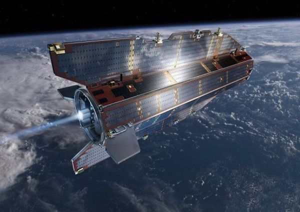
ESA launched the GOCE to obtain information on matters related to Earth’s gravity in details. The satellite that was launched in 2009, is the first part of its ‘Earth Explorer’ programme. It is five metres long (16 feet) and weighs 1,050 kilogrammes (2,310 pounds). It is placed at a relatively low orbital position 260 kilometres (160 miles) above the planet, so it can catch even the slightest variation in Earth’s gravitational field with the minutest detail. Now after nearly two years in the space, it has collected some raw data, which will help the scientists understand the impact of climate change on sea levels, ice sheets, and ocean circulation systems in a better light.
Earth Observing System satellite – EOS Aura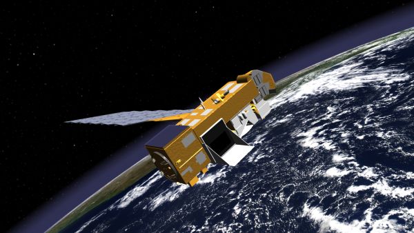
Launched on 15 July 2004 from Vandenberg Air Force Base, California, Aura was safely deployed into orbit 705 kilometers (438 miles) above Earth. Along with Terra and Aqua, it is the third and the final of NASA’s Earth Observing System (EOS) flagships, launched with a view to understand our world’s atmosphere better, so it can be protected better.
Aura will assist the scientists by tackling three main questions: Is the Earth’s protective ozone layer recovering, what are the processes controlling air quality and how is the Earth’s climate changing? It will also assist in understanding how the changes in Earth’s climate effect the composition of atmosphere.
Its Ozone Monitoring Instrument detected extremely high levels of aerosol particles and sulfur dioxide on October 8, 2010. The sulfur dioxide typically comes from coal-burning power plants and smelters, and the peak concentrations – 6 to 8 Dobson Units – were six to eight times the norm for China and 20 times the norm for the United States.
Earth Observing System satellite – EOS Aqua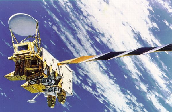
Launched in 2002, Aqua is one of a series of orbiting Earth Observing System (EOS) platforms that are central to NASA’s long-term study of the planet and its processes.
The Aqua Earth Observing System deals closely with the effects of global change. Backed by a remote sensing spacecraft, a data distribution system and an international and multi-disciplinary teams of researchers, its objective is to provide a scientific basis for understanding the scope, dynamics and implications of global change.
Armed with on-board sensors that measure clouds, precipitation, atmospheric temperature/moisture content, terrestrial snow, sea ice, and sea surface temperature, EOS Aqua does the job of collecting all data related to Earth’s climate. It is placed in low-earth orbit and each afternoon it passes over the same place to collect complete data for assessment of long-term changes.
Earth Observing System satellite – EOS Terra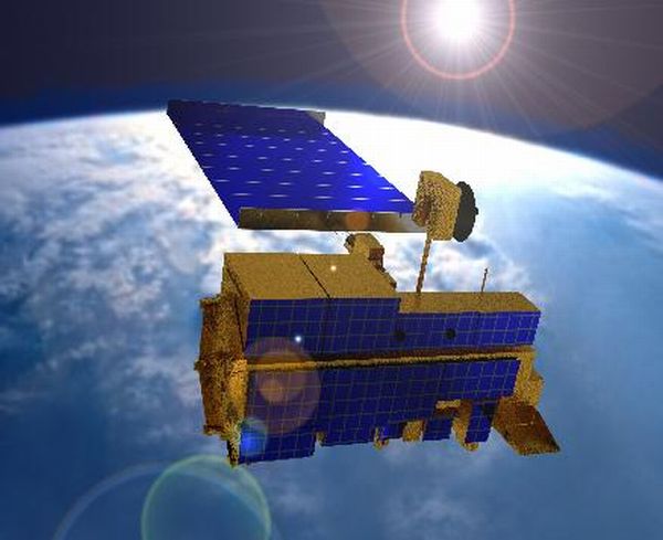
Launched in 1999, Terra is the first spacecraft of a large scale Earth Observation Program of NASA. Formerly known as EOS-AM1, Terra is armed with five remote sensors designed to monitor the state of Earth’s environment and ongoing changes in its climate system. Terra has to collect data about pollution in the world, so there are instruments on Terra to examine trends in global carbon monoxide and aerosol pollution.
TRMM satellite- Tropical Rainfall Measuring Mission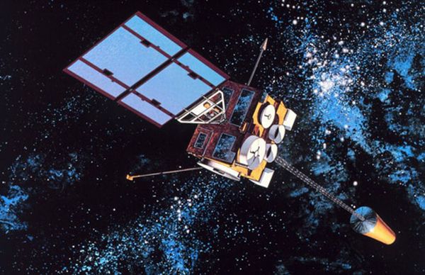
The Tropical Rainfall Measuring Mission (TRMM) satellite was launched in November 1997. The objective of this satellite is to show clearly the transfer of heat and water vapor between the ocean and atmosphere. The TRMM is a project of NASA devoted to measuring precipitation in the tropics and subtropics of the earth. It provides data for testing of climate models and their improvement. The TRMM carries three main instruments on it. But The Precipitation Radar is its most novel instrument. It qualifies as the first spaceborne instrument designed to provide three-dimensional maps of storm structure built by the National Space Development Agency (NASDA) of Japan. It is being said that it will contribute invaluable information on the intensity and distribution of the rain, on the rain type, on the storm depth and on the height at which the snow melts into rain.
The Landsat 7 Satellite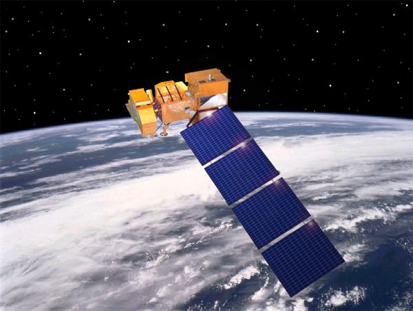
The LANDSAT-7 satellite was successfully launched from Vandenburg Air Force Base on April 15, 1999. It weighs 5000 pounds and has been designed for a 705km, sun-synchronous, earth mapping orbit with a 16-day repeat cycle. Landsat 7 was programmed for a life of 5 years, with the ability to transfer 532 images per day. Landsat 7’s primary goal was to refresh the global archive of satellite photos, providing up-to-date and cloud-free images.
Formosat3 / COSMIC (F3C)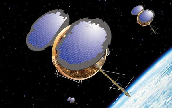
Formosat3 / COSMIC (F3C) mission was successfully launched from Vandenberg Air Force Base, California on 15 April 2006. It is a joint Taiwan – US science mission for weather, climate, space weather and geodetic research. Six identical micro satellites, each carrying an advanced GPS radio occultation receiver, a Tiny Ionospheric Photometer (TIP) and a Tri Band Beacon (TBB) were deployed successfully were positioned at 500 km from Earth in the orbit.
CloudSat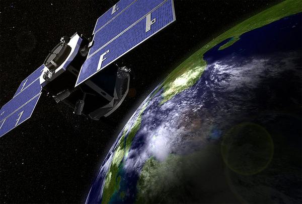
Launched on a Delta II rocket on 28 April 2006, CloudSat is an Earth observation satellite by NASA. The Cloud Profiling Radar (CPR), a 94-GHz nadir-looking radar that measures the power backscattered by clouds as a function of distance from the radar, is its most important component. It was developed at NASA’s Jet Propulsion Laboratory (JPL) in Pasadena, California, with hardware contributions from the Canadian Space Agency. It uses radar to measure the altitude and properties of clouds, adding to information on the relationship between clouds and climate in order to help resolve questions about global warming. CloudSat flies in formation in the “A Train”, with several other satellites (Aqua, Aura, CALIPSO and the French PARASOL).
CALIPSO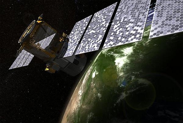
CALIPSO was built in the Cannes Mandelieu Space Center as a joint NASA (USA) and CNES (France) environmental satellite. It was launched on a Delta II rocket on April 28, 2006. Calipso is a short form of “Cloud-Aerosol Lidar and Infrared Pathfinder Satellite Observations.” It is fitted with passive and active sensing Instruments to monitor aerosols and clouds 24 hours a day. It orbits close to other satellites such as Aqua and Cloudsat in “A Train” constellation. Its main objective is to aid scientists in a better understanding of the climatic systems and predict changes therein.
TerraSAR-X Satellite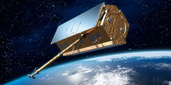
Launched June 15, 2007, TerraSAR-X is a German Earth observation satellite. It is a joint venture the German Aerospace Center DLR and EADS Astrium GmbH. It has been operational since January 2008. Its active phased array X-band SAR antenna (wavelength 31 mm, frequency 9.6 GHz) gives TerraSAR-X new high-quality radar images of the entire planet as it orbits at an altitude 514km.. The 1230kg satellite has been programmed to function immaterial of weather conditions and illumination for a period of 5 years. It can produce radar images of up to 1m. TerraSar-X’s innovative zoom shot that can change the resolution and scanning field vice-versa in a relationship of 1:10.