How do hurricanes form in West Africa before they go bowling across the Atlantic, slamming into the southeastern United States and the Caribbean? To understand or study this, U.S. weather experts have developed rotating radars, launching 3 small white helium balloon into the air — one in landlocked Niger’s capital Niamey, second in Kawsara on the Senegalese coast, and one on the Cape Verde Islands. The agency is also flying planes into the center of the depressions.
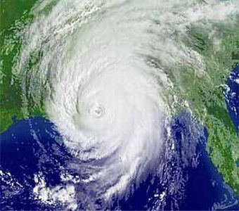
U.S. space agency NASA backed this study, helping forecasters better predict the devastating hurricanes like – Katrina. This killer hurricane formed over Africa, killing around 1,500 people when it lashed into New Orleans leaving a nightmarish devastation a year ago in American history.
Greg Jenkins, a specialist in tropical meteorology from Howard University, Washington told Reuters,
This is the first time with aircraft, with radars on the ground that we can look inside these disturbances. And once you understand what’s happening inside you have a better chance of predicting.


