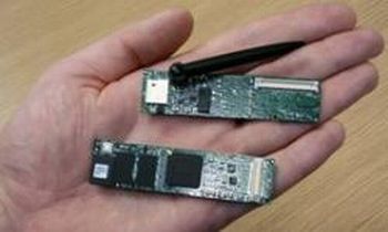
Capable of monitoring river water depth and flow, a “grid” of river sensors will be installed in a UK river to predict its impending flooding. This network is capable of producing more accurate and concise data compared to the existing monitoring systems.
It could provide locals and government decision-makers earlier warning of rising trouble earlier enough to help them take actions. Though only two of thirteen sensor nodes have so far been installed — along a kilometer stretch of the River Ribble, in the Yorkshire Dales — the rest of the network is scheduled to be placed by the end of the year.
The final network will be containing three sensor node kinds:
Eleven will be measuring pressure from below the waterline to determine depth.
Two will be monitoring the river flow speed – one using ultrasound underwater, and the other using webcams, for tracking objects and ripples that move along the surface, from the riverbank.


